Ports Primer: 5.2 Land Use
Land use at ports can have a direct impact on neighboring residential communities. Impacts can include:
- Competition between port land uses and community land uses as ports expand.
- Loss of residential and commercial property through the exercise of eminent domain.
- Potential for decreased property values for residents of near-port communities.
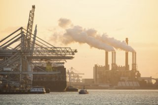
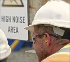
- Air and noise pollution from machines, trucks and ships, locomotives and cargo-handling equipment as well as channel maintenance and expansion.
- Light pollution from both constant and flashing lights.
Ports are also often co-located with other heavy industries. The combined effect of port operations along with operations at neighboring facilities may create a disproportionate burden for communities located near ports.
Land Use Regulations

Land use is typically regulated at the local level by city and county governments.
In some instances, the port authorityA government entity. A port authority may own facilities in one or more ports, and a port authority’s domain may include both seaports and airports. It may be difficult to tell visually where the control of a port authority ends. For example, port authorities do not control private terminals (except in as much as landlord ports can impose lease-based controls on private terminal tenants), military operations and industrial facilities located in or around port facilities. less Definition 2: Autonomous (independent) port authority: a self-sustaining, self-governing public body. Definition 3: Semi-autonomous (semi-independent) port authority: a public body subject to certain state controls. Definition 4: Bi-state or regional port authorities: a public body created by agreement between two or more states. Definition 5: Port authorities with limited agency or power: a public body limited to certain actions such as bonding. Definition 6: Divisions of state, county or municipal government: a government department. Definition 7: Independent port or navigation districts: entities that function as "special purpose" political subdivisions of a state with defined geographic boundaries over which they have authority. itself may be set up as a political subdivision of the state called an independent port or navigation district. In these instances, the port district may have regulatory control of land use within their jurisdiction.
Federal agencies, including EPA, do not have direct authority over zoning and other land use decisions made at the local level. Land use decisions at the state or local level may be subject to NEPA requirements if federal funding is involved. Also, some states have state requirements that may affect land use decisions.
Port Expansion Alternatives1
With ever-growing demands to increase capacityThe available space for, or ability to handle, freight., ports are faced with hard choices about how and where to expand. Options can include:
- Increasing land use efficiency of existing terminalA designated area of a port used for the transmission, care and convenience of cargo and/or passengers in the interchange of them between land and water carriers or between two water carriers. It includes wharves, warehouses, covered and/or open storage spaces, cold storage plants, grain elevators and/or bulk cargo loading and/or unloading structures, landings, and receiving stations.s in order to maximize capacity and reduce the need for physical expansion of the port.
- Exercise eminent domain to acquire land.
- Physically expand into greenfields (previously undeveloped land), which can sometimes minimize near-term expansion costs.
- Physically expand into brownfields (previously developed properties). This can limit impacts on previously undeveloped land but can also be challenging due to real or perceived contamination from prior uses.
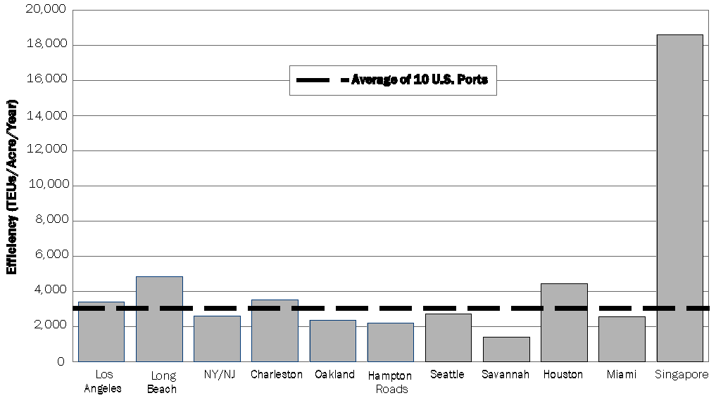
U.S. ports are much less efficient in terms of land use than some international ports. Efficiency can be measured in terms of the volume of cargoThe freight (goods, products) carried by a ship, barge, train, truck or plane. processed per acre over a set period of time. The volume of cargo is typically measured using the dimensions of standard shipping container (called a TEU or twenty-foot equivalent unitA unit of measurement equal to the space occupied by a standard twenty-foot container. Used in stating the capacity of container vessel or storage area. One 40-foot container is equal to two TEUs.). A host of factors contribute to operational efficiency, so it is important to consider the implications of safety regulations, environmental protection requirements, etc. when contemplating efficiency at US ports and foreign ports. The chart below shows the land use efficiency of 10 U.S. ports compared to the Port of Singapore.

Strategies for Alleviating Other Port-Related Impacts

Because ports are often co-located with other heavy industries, it can be difficult to identify what land use impacts are being created directly by the port. Identifying the source of the impact is an early step in understanding options for influencing changes.
Strategies for addressing the land use impacts of ports on near-port communities can include:2
- Using low-profile cranes to reduce aesthetic impacts.
- Minimizing noise and light pollution in areas where the port is adjacent to residential communities.
- Developing port traffic mitigation plans, which can include strategies such as traffic mitigation fees, extended hours for terminal gates, specified truck routes and on-dock railA railyard connected directly to a dock. facilities.
Potential Health Impacts

Impacts from port and port-related land uses can affect the health of near-port communities. Health impacts can include:
- Limited access to greenspace, outdoor recreation and natural areas.
- Hearing impairment, high blood pressure and loss of sleep from noise pollution.
- Disruption of biological rhythms from light pollution.


