Fort Ord Site Spotlight

Congratulations to the former Fort Ord for winning the 2020 National Federal Facility Excellence in Site Reuse Award in the NPL Base Realignment and Closure (BRAC) category! The Fort Ord Cleanup Team, consisting of the U.S. Army, EPA, California Environmental Protection Agency’s Department of Toxic Substances Control (DTSC) and California Regional Water Quality Control Board (RWQCB), Fort Ord Reuse Authority (FORA) and the Bureau of Land Management (BLM), partnered to transform this former Army installation into a vibrant and growing community. Once complete, their combined efforts are projected to benefit more than 37,000 residents and 18,000 employees with over three million square feet of public services and commercial space in the Monterey Bay area; increased educational opportunities through the creation of California State University Monterey Bay (CSUMB) and an additional campus for Monterey Peninsula College (MPC); and thousands of acres for open space, critical habitat for threatened and endangered species, and recreational opportunities.
Photo Credit: Fort Ord Reuse Authority (FORA)
(1 of 10)
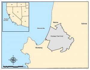
Fort Ord is a former Army post located adjacent to Monterey Bay in northwestern Monterey County, California, approximately 80 miles south of San Francisco. The former base consists of approximately 28,000 acres adjacent to the cities of Seaside, Sand City, Monterey, and Del Rey Oaks to the south and the city of Marina to the north.
Beginning in 1917, Fort Ord served primarily as a training and staging facility for infantry troops. The Army originally bought the eastern portion of Fort Ord in 1917 to use as a maneuver and training ground for field artillery and cavalry troops stationed at the Presidio of Monterey. In the late 1930s, the administrative buildings, barracks, mess halls, tent pads and a sewage treatment plant were constructed and additional agricultural property was purchased for the development of the Main Garrison. At the same time, the beachfront property was donated to the Army. Between 1940 and the 1960s, many improvements and expansions occurred, also adding a small airfield. In the early 1960s, construction of the Fritzsche Army Airfield was completed. The smaller Main Garrison airfield was then decommissioned and its facilities were redeveloped as motor pools and other facilities. From 1947 to 1974, Fort Ord was a basic training center. The 7th Infantry Division was activated at Fort Ord in October 1974 and occupied Fort Ord until its closure. The 7th Infantry Division was converted to a light division in 1983. In 1991, Fort Ord was selected for closure; the post was officially closed in September 1994.
Photo Credit: Fort Ord Cleanup
(2 of 10)
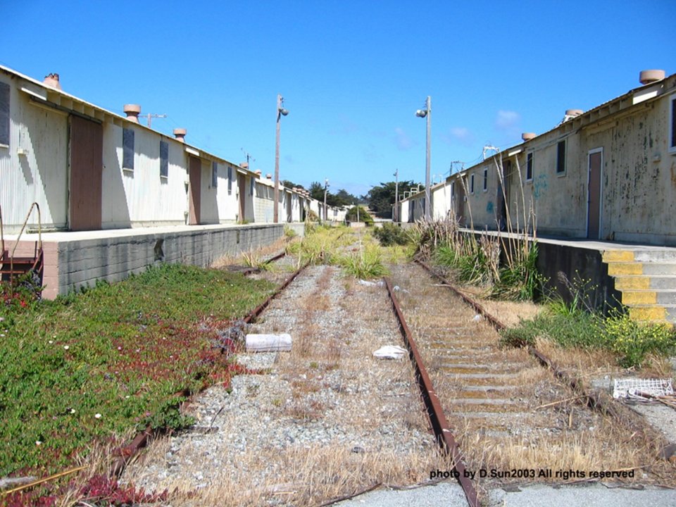
Fort Ord closed due to a Base Realignment and Closure (BRAC) action. As one of the largest closures in U.S. military base history, the closure devastated the local economy. The Army retains the Ord Military Community and the U.S. Army Reserve Center located at the former Fort Ord. The remainder of Fort Ord was identified for transfer to federal, state and local government agencies and other organizations, and has been in the reuse process since base closure. Future reuses of the land are designated in the Fort Ord Base Reuse Plan (BRP) and the Installation-Wide Multispecies Habitat Management Plan for Fort Ord.
Adopted in 1997, the BRP was developed by FORA, with a Board of Directors representing the interests and priorities of local communities. The BRP directed FORA’s statutory mission: “The vision…is that a community will grow up on the former base, having a special character and identity…it will provide a diversity of experience and opportunity, with a development approach that is sustainable and appropriate.” The BRP provides the policy and land use framework to guide the reuse and recovery process. Framed on the principles of the “3 Es”, Economic Recovery, Educational Reuse, and Environmental Conservation, the reuse undertaking provides a balanced, resource-constrained program yielding new educationally-centered communities, vast areas of open space and conserved native habitats, new housing and job opportunities, and anticipated vibrant new town centers.
Photo Credit: California State University – Monterey Bay
(3 of 10)
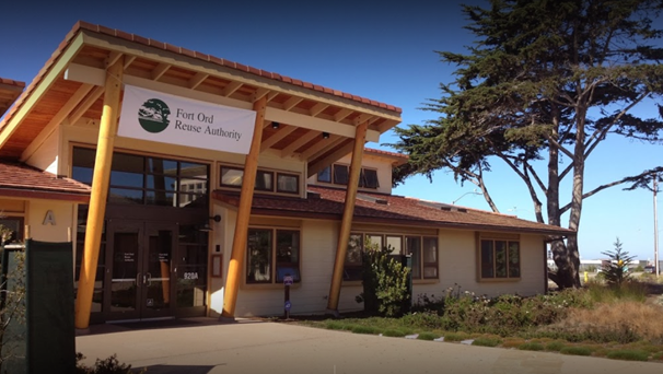
The U.S. Army, with EPA and state oversight, set goals to protect human health and the environment; promote the preservation, enhancement and restoration of habitat; and transfer property for land uses determined by the reuse plan. As part of the cleanup, Army and FORA negotiated an innovative Environmental Services Cooperative Agreement (ESCA) to privatize the cleanup of munitions on approximately 3,340 acres of the site. The Army awarded $98 million to FORA to perform the cleanup program under the ESCA. FORA also entered an Administrative Order on Consent (AOC) with EPA and DTSC, which defined the regulatory requirements for the munition cleanup by the reuse authority.
For more information, check out EPA’s factsheet, Former Military Bases Now Host Dynamic Mixed Uses, Address Economic and Community Priorities (pdf).
Photo Credit: Fort Ord Reuse Authority (FORA), Google Maps
(4 of 10)
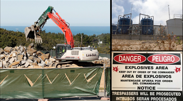
The Army continues to clean up three areas of groundwater contamination under the former Fort Ord: Operable Unit 2, Sites 2/12 and Operable Unit 12 (Carbon Tet Plume). These groundwater plumes have reduced in size significantly since clean-up began and 10.54 billion gallons of groundwater have been treated. A larger, more efficient groundwater treatment plant for Operable Unit 2 became operational in February 2019.
The Army prioritized early and complete soil cleanup in numerous discrete sites, primarily located in former light industrial and maintenance use areas. These expedited cleanup decisions released many areas for unrestricted use redevelopments. The soil cleanup goals were conservative and provided for protection of groundwater and natural resources. For munitions, a “plug-in” process was used that “plugged” smaller areas into the CERCLA site remedy once they met specific cleanup levels. This method expedited the cleanup and was ultimately adopted for use at other munitions cleanup sites.
Photo Credit:
(Left) Monterey Herald (Vern Fisher)
(Top Right) Monterey County Weekly
(Bottom Right) U.S. Army, Fort Ord Cleanup
(5 of 10)
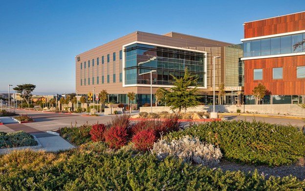
Over 19,000 acres of the former Fort Ord property have been transferred for reuse. A large portion of the Inland Training Ranges was assigned to the BLM. Other areas on the base have been, or will be, transferred through economic development conveyance, public benefit conveyance, negotiated sale or other means. The major property recipients are BLM, California State Parks, California State University Monterey Bay (CSUMB), University of California, FORA, City of Marina, City of Seaside and the County of Monterey.
Major reuse and redevelopment to date includes California State University Monterey Bay, Fort Ord Dunes State Park, a new campus of Monterey Peninsula College, Fort Ord National Monument, California Central Coast Veterans Cemetery, the Major General William H. Gourley VA-DOD Outpatient Clinic, The Dunes on Monterey Bay retail center, multiple new housing developments including senior and low-income communities, The Ord Military Community and more to come.
Photo Credit: BFS Landscape Architects, Photographer Marc Howard
(6 of 10)
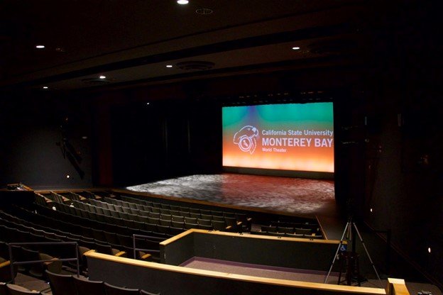
The California State University Monterey Bay (CSUMB) established its campus in 1994 on 1,350 acres of the former base. The University repurposed some of the Army era structures for their campus including the stadium, recreational facility and barracks. CSUMB alleviated a critical college shortage for underserved and low-income students. Today, CSUMB is a thriving active campus that has more than 7,000 full-time students and 1,000 faculty and staff. A student population of 15,000 is anticipated by 2025, with continued growth projected beyond that.
The redevelopment efforts also included the construction of over 11,000 mixed-use housing units that include affordable fixed-income, single-family, beachfront and senior living. With these redevelopment efforts, over 18,000 jobs were created within the former installation.
Photo Credit: California State University Monterey Bay
(7 of 10)
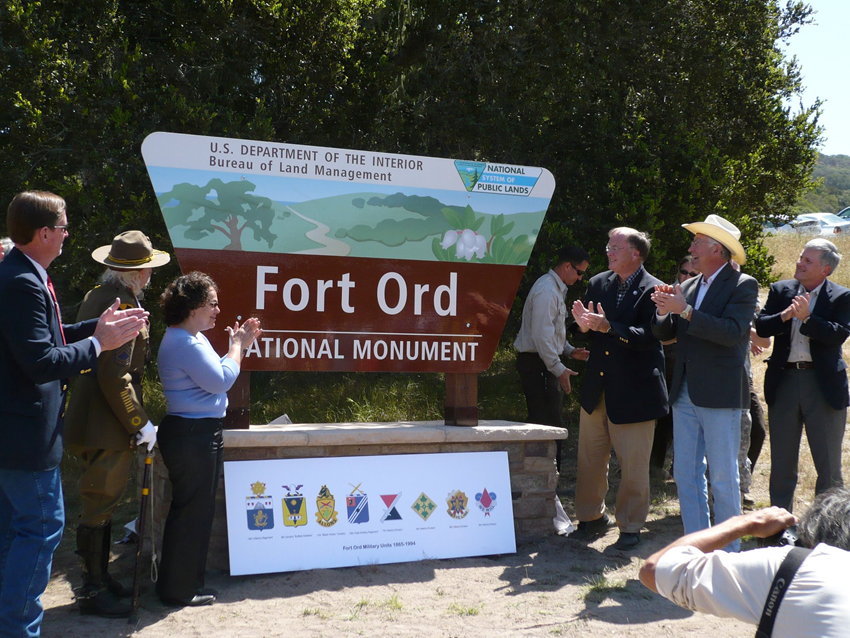
Since base closure, BLM has partnered with the Army to provide land management on portions of the former Fort Ord. In 1996, while the Army continued their environmental cleanup, 7,204 acres of the habitat property were transferred to BLM to create public recreational spaces. BLM continues to provide habitat management services to the Army on the remaining lands that have yet to be transferred. These services contribute to fulfilling the Army's obligations identified in the Installation-Wide Multispecies Habitat Management Plan and support the continued environmental cleanup and habitat management activities on land still under Army control.
In 2012, 14,650 acres of the site became the Fort Ord National Monument. This coastal gem preserves some of the last undeveloped natural areas and public lands on California’s Monterey Peninsula. More than 86 miles of trails provide opportunities to hike, bike or ride horses through rolling hills, pockets of chaparral and oak woodlands. Diverse habitats include streamside corridors, grasslands, maritime chaparral, oak woodlands and seasonal pools.
Photo Credit: Fort Ord Reuse Authority
(8 of 10)
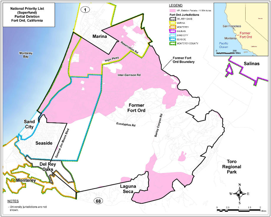
On May 14, 2021 EPA deleted 11,934 acres of the Fort Ord site from the National Priorities List (NPL). The remaining portions of the site will remain on the NPL. The groundwater media, soil gas media and all media associated with areas being evaluated for the presence of per- and polyfluoroalkyl substances (PFAS) compounds will remain on the NPL.
Photo Credit: Fort Ord Cleanup
(9 of 10)
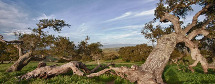
The combined efforts at this former military installation created jobs, added housing, fostered economic development, increased community access to recreation, created new educational opportunities and restored the environment. The former Fort Ord is a recipient of the 2020 National Federal Facility Excellence in Site Reuse Award. The creative reuse and restoration of the site will support the community for generations.
Photo Credit: Bureau of Land Management
(10 of 10)
