Climate Adaptation Profile: Rocky Mountain Arsenal
Commerce City, Colorado
Site Description
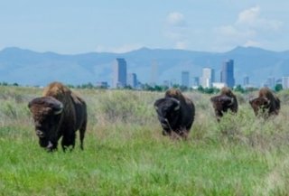
Cleanup at the Rocky Mountain Arsenal over the past 45 years has addressed approximately 3,000 acres of soil and 15 groundwater plumes. Activities associated with past use of this federal facility to manufacture chemicals and incendiary munitions resulted in soil and groundwater contamination from assorted wastes such as organochlorine pesticides, heavy metals and chlorinated and aromatic solvents. This National Priorities List (NPL) site originally covered approximately 17,000 acres of semiarid Colorado plains near the city of Denver and foothills of the Rocky Mountains. To date, nearly 16,000 acres of the site have been deleted from the NPL. The Rocky Mountain Arsenal National Wildlife Refuge (Refuge) now occupies approximately 15,000 acres of the site.
Remediation Activities
Onsite soil remediation entailed placing the most contaminated soil and demolition debris into two hazardous waste landfills, installing permanent caps over the closed landfills, and constructing six evapotranspiration (ET) covers above consolidated, less contaminated soil and debris. A subsurface slurry wall was constructed to prevent contaminant migration from former lime treatment basins and waste disposal trenches. Long-term monitoring and maintenance of the caps and covers and associated stormwater drainage structures and access roads continues.
Ongoing remediation of groundwater involves operating five groundwater extraction and treatment systems whereby the extracted water is treated via granular activated carbon adsorption. To maintain hydraulic control of the groundwater plumes, the treated groundwater is reinjected into the aquifer at downgradient recharge trenches. Additionally, six dewatering wells equipped with sumps are used to maintain an effective gradient for the slurry wall and remove dense nonaqueous-phase liquid associated with the lime treatment basins.
Vulnerability to Climate Change Impacts
The site is vulnerable to drought conditions and to localized flooding associated with intense or prolonged precipitation. For example, more than 15 inches of rain fell in the Rocky Mountain front range over a single week in September 2013, which is equivalent to the area’s average precipitation in one year. The National Oceanic and Atmospheric Administration categorized the event as a 500- to 1,000-year storm. Due to associated breaching and washout of an onsite dam, more than 400 acres of the Refuge were submerged during the event’s peak flooding. Flooding vulnerability was exacerbated by drought conditions that prevailed prior to the storm, which reduced soil capacity to rapidly absorb the heavy precipitation.
Remedy components of highest concern are the six ET covers and two landfill caps, which are positioned on a total of 450 acres and 84 acres, respectively, surrounded by prairie grasslands of the Refuge. Each ET cover includes a capillary barrier and a top layer of vegetation underlain by fine-grained soil amended with organic material. Both the ET covers and landfill caps are vulnerable to potential soil erosion or sinkhole development caused by intense or prolonged precipitation.
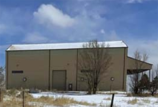
Potential wildfires pose additional threats to the site’s existing infrastructure such as the onsite buildings used for cover system maintenance and groundwater treatment. For example, in December 2021 the Marshall Fire occurred in neighboring Boulder County. The fire began as a grass fire and quickly spread across more than 6,000 acres due to an unusually high amount of dry grass acting as fuel, a low amount of recent snowfall, and wind gusts exceeding 100 miles per hour.
Building Adaptive Capacity for Future Climate Scenarios
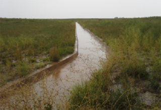
Each ET cover includes a biointrusion layer made of recycled concrete, which provides high durability, compressive strength and resistance to moisture-induced degradation potentially caused by water associated with intense or prolonged precipitation. Additionally, the ET covers’ drainage systems were designed to convey runoff produced by a 100-year, 24-hour storm event. The drainage channels for each cover consist of 4-inch slotted pipe surrounded with a 6-inch layer of gravel and wrapped with geotextile secured beneath 4 feet of soil overlain by solid concrete. A total of 2.5 miles of drainage channels, ranging from 150 to 2,246 feet in length, were installed at grades of 0.3 to 1 percent across the 450 acres with ET covers. During the 2013 storms, sheet flow crossing the covers effectively drained to the concrete channels. The covers’ shallow slopes, as well as the slopes’ relatively short lengths (generally less than 500 feet), helped minimize formation of rills or gullies.
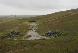
Drainage systems for the landfill caps were designed to withstand a 1,000-year, 24-hour storm event. Surface water controls for each cap include a series of terrace channels to direct water off the cap’s surface. The terrace channels then direct stormwater to downchutes terminating in basins equipped with energy dissipaters. The collected stormwater drains to unlined channels that allow infiltration at locations farther from the landfills. Critical portions of the channels are armored with articulated concrete block. Excess sediment accumulating at the end of the stormwater channels is removed, as needed. During the 2013 storms, sheet flow effectively drained from the landfill caps and development of erosion rills was minor. Instrumentation, pumps and auxiliary systems housed within the onsite buildings used for remediation suffered no damage.
The top layer of vegetation in the landfill caps as well as the ET covers reinforce their capabilities to withstand extreme wind or precipitation and avoid related erosion. The vegetation comprises a diverse mix of cool and warm season native plants that are adaptable to dry and wet periods and resistant to pathogen and pest outbreaks potentially resulting from the area’s changing climate. Additionally, each landfill cap system includes a one-foot-deep layer of rock-amended soil directly beneath the vegetative layer to minimize the effects of potential erosion in the event of vegetation damage. Animal grazing is currently prohibited on the landfill caps and ET covers.
As manager of the Refuge, the U.S. Fish & Wildlife Service (USFWS) prepared a comprehensive conservation plan that considers regional climate change effects such as altered precipitation patterns, wildfire frequency and intensity, and dominating ecosystems. The USFWS and U.S. Army collaborate in collecting meteorological data that may be used to identify such trends. Annual quantitative inspections of the vegetation on each ET cover provide opportunities to evaluate whether viability of individual plant species may be affected by recent weather events or sustained changes in regional climate. Ongoing monitoring includes visual inspections of the ET covers at least seven times each year for erosion, burrowing animals and overall integrity. Soil settlement and sheet erosion in the covers is monitored through use of steel monuments.
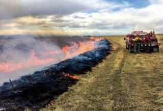
The USFWS maintains the practice of periodically conducting prescribed burns on the Refuge and adjoining Army-maintained property to reduce the fuel available for potential wildfires. For example, the USFWS conducted a prescribed burn on approximately 2,700 acres over a two-week period in October 2021. Burning excessive vegetative litter while personnel and firefighting equipment are on hand reduces the severity of an unplanned fire. This practice also helps maintain or restore the desired perennial grasses providing habitat for native and migratory wildlife, prevents onsite growth of invasive plant species, and fosters local biodiversity.
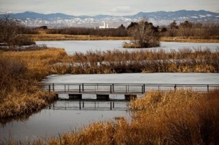
Reinjection of the site’s treated groundwater and its storage in the underlying aquifer enhances the community’s resilience to temporary or extended drought conditions. Additional drought resilience is provided by surface water maintained in three onsite lakes, which collectively receive and retain the site’s stormwater. One of the lakes (Lake Ladora) also receives recycled water purchased from Denver Water, the local public water utility.
The USFWS maintains optimal water levels in the onsite lakes to ensure fresh water is available to support the Refuge, which is open to the public. Two of the lakes (Lake Ladora and Lake Mary) provide a warm water recreational fishery for populations of green sunfish, bluegill sunfish, largemouth bass and other native or desirable naturalized game and forage fish species identified by the USFWS. The third lake (Lower Lake Derby) is maintained with the primary goal of supporting an annual minimum of 50,000 use-days by migratory waterfowl between October and April.
Superfund Climate Resilience
EPA provides additional information about approaches for building climate resilience at Superfund sites.
Overview of Climate Resilience
In collaboration with the USFWS, the U.S. Army incorporated resilience measures into the site remedies’ designs, construction, and long-term operation, maintenance and monitoring:
- Designed the landfill cap drainage systems to withstand a 1,000-year, 24-hour storm event rather than the typical 100- or 500-year 24-hour storm event.
- Armored the ET covers’ and landfill caps’ drainage channels with solid or articulated concrete block.
- Vegetated the ET covers’ and landfill caps’ top layers with mixes of plants tolerant of drought and resistant to disease or pests.
- Incorporated a one-foot layer of rock-amended soil in top portions of the landfill caps to ensure the caps remain resilient to erosion if overlaying vegetation becomes damaged.
- Installed steel monuments at key field locations to facilitate identification of any repairs needed due to sheet erosion or soil settlement in the ET covers.
- Collecting meteorological data for use in identifying climate change effects at the site.
- Conducting periodic prescribed burns to expend potential wildfire fuels in a controlled a manner while fostering local biodiversity and habitat.
- Storing site-wide stormwater in onsite lakes for its gradual infiltration into underlying soil.
- Beneficially using all of the site’s treated groundwater to recharge the local aquifer.
Key Tools Used for Climate Projections
- Climate Hydrology Assessment Tool (CHAT), U.S. Army Corps of Engineers
- Climate Change Vulnerability Assessment of Aquatic and Terrestrial Ecosystems in the U.S. Forest Service Rocky Mountain Region, U.S. Forest Service, RMRS-GTR-376, June 2018
- Colorado Climate Change Vulnerability Study, University of Colorado Boulder and Colorado State University, January 2015
- Rocky Mountain Arsenal: Hazardous Waste Landfill Groundwater Monitoring Wells 25194 and 25184 Subsurface Soil and Landfill Stormwater Runoff Data Summary Report, Navarro Inc., 2019
Points of Contact
- David Connolly, U.S. EPA Region 8
- Robert Stites, U.S. EPA Region 8
- Sai Appaji, U.S. EPA Region 6
- David Lucas, USFWS
- Scott Greene, U.S. Army
References
- Superfund Sites: Rocky Mountain Arsenal, Colorado Department of Public Health & Environment
- Losing the Forest for the Trees, PERC Reports, Property and Environment Research Center, Summer 2022
- The Marshall Fire: Could it Happen Here, Front Porch, April 1, 2022
- Rocky Mountain Arsenal: Fifth Five-Year Review Report, U.S. Department of the Army, September 2021
- Rocky Mountain Arsenal: Land Use Control Monitoring Report for Fiscal Year 2022, U.S. Department of the Army and Shell Oil Company, December 7, 2022
- Rocky Mountain Arsenal: 2022 RCRA Landfills and Groundwater Monitoring Report, U.S. Department of the Army and Shell Oil Company, June 17, 2022
- Comprehensive Conservation Plan: Rocky Mountain Arsenal National Wildlife Refuge, U.S. Fish and Wildlife Service, December 2016
- Management Plan for Protection and Monitoring of Lake Ladora, Lake Mary and Lower Derby Lake During RMA Remediation, U.S. Fish and Wildlife Service, January 2006
May 2023
