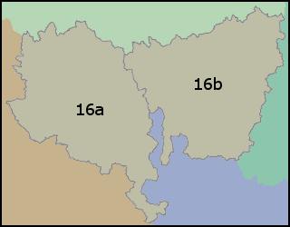
NHDPlus Great Basin Data (Vector Processing Unit 16)

Each major drainage area of the United States contains a suite of NHDPlusV2 data. Within a drainage area, the NHDPlusV2 data components are packaged into compressed files either by Vector Processing Unit (VPU) or Raster Processing Unit (RPU). A drainage area is composed of one or more VPUs and a VPU is composed of one or more RPUs.
| Drainage Area ID | GB |
|---|---|
| VPU | 16 |
| RPUs | 16a, 16b |
The following links exit the site
NHDPlusV2nn_<dd>_<VPUid>_componentname_<vv>
or
NHDPlusV2nn_<dd>_<VPUid>_<RPUid>_componentname_<vv>
where:
- V2nn is Version (2) and subversion (nn) of the NHDPlusV2 data model
- dd is the drainage area identifier
- VPUid is the VPU identifier
- RPUid is the RPU identifier
- Componentname is the name of the NHDPlusV2 component contained in the file
- vv is the data content version, 01, 02, ... for the component
Additional information about the NHDPlusV2 content and distribution format
can be found in the
NHDPlusV2 User Guide (pdf)
