Superfund Sites in Reuse in New Hampshire
If you are having trouble viewing the map in your browser, click the 'View larger map' link below
AUBURN ROAD LANDFILL

The 200-acre Auburn Road Landfill Superfund site is in Londonderry, New Hampshire. It includes three disposal areas that cover about 12 acres. A disposal area for chemical wastes, tires, demolition debris and solid waste was on-site from the 1960s to 1980. The state of New Hampshire found contamination in soil, groundwater and surface water and ordered the landfill’s closure in 1980. The EPA added the site to the National Priorities List (NPL) in 1983. Cleanup activities included capping and fencing of contaminated areas as well as the extension of the public water supply to nearby homes. Groundwater sampling is ongoing. Parts of the site are now in residential reuse. A portion of the Whispering Pines Mobile Home Park lies on the northern part of the site. The town of Londonderry created about 7 acres of wetlands partially on-site to reduce the amount of groundwater keeping contact with the capped waste. In May 2021, the town requested the EPA approval to build a radio transmission tower on-site to improve communication among the town’s fire, police and public works departments. EPA, in consultation with New Hampshire Department of Environmental Services, approved the location of the project. Local discussions for project next steps are ongoing.
Last updated September 2024
As of December 2023, the EPA had data on one on-site business. The EPA did not have further economic details related to this business. For additional information click here.
For more information:
BEEDE WASTE OIL
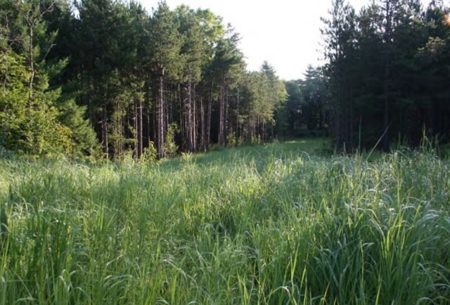
The Beede Waste Oil Superfund site is in Plaistow, New Hampshire. The 40-acre area comprises two parcels of land. Commercial waste oil reclamation and asphalt batching operations were located on what is referred to as Parcel 1. Parcel 2 was primarily undeveloped land used for sand and gravel operations. In fall 1983, sampling found chemical contamination in a residential well near the site. About 100 aboveground storage tanks, a 140,000-gallon below-ground tank and 800 drums were on-site. The EPA added the site to the National Priorities List (NPL) in 1996. The EPA led a removal action in 2005 to reduce the 4-acre mobile oil plume under the former lagoon, tank storage and landfill area of the site that was migrating into nearby Kelley Brook. On-site soil is contaminated with polychlorinated biphenyls (PCBs), petroleum hydrocarbons, volatile organic compounds (VOCs) and lead. Phases 1 and 2 of thermal operations successfully treated deeper soils using steam injection to remove VOCs and residual oils for treatment. VOCs and 1,4-dioxane and metals are found in groundwater on-site as well as in nearby residential supply wells. Sampling also found per- and polyfluoroalkyl substances (PFAS) in the groundwater. In 2002, the town received an EPA Superfund Redevelopment Program pilot grant to evaluate future land use options for the site. It identified senior housing, recreation and a community center as community priorities. The EPA selected the site’s long-term remedy in 2004. It included excavation and off-site disposal of soils and the on-site landfill within the top 10 feet and treatment of soils at depth via thermal treatment to reduce VOC concentrations and leaching into groundwater, the removal of mobile light non-aqueous phase liquids (LNAPLs) and restoration of excavated areas. It also included pumping and treating contaminated groundwater on-site, and long-term monitoring of surface water, sediment and groundwater. Residual mobile oils remain on-site. Actions to address this material are ongoing meanwhile belt skimmers continue to remove residual oil from the subsurface. The site is not in use. Landowners and the town continue to assess reuse opportunities compatible with the residential cleanup, such as a park and as wildlife habitat. Currently there is a small, temporary habitat area maintained where tree removal took place for the site’s groundwater treatment plant which provides habitat for local pollinators and wildlife. The final phase of the cleanup for Site soils is under design and updates to lead and PFAS cleanup standards will be considered as will the reuse and redevelopment.
Last updated September 2024
As of December 2023, the EPA did not have economic data related to on-site businesses, or economic data were not applicable due to site use. For additional information click here.
For more information:
FLETCHER'S PAINT WORKS & STORAGE
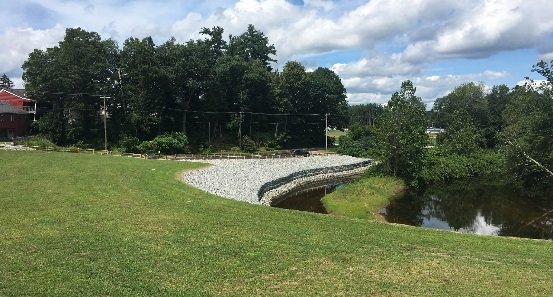
The Fletcher’s Paint Works & Storage Superfund site is in Milford, New Hampshire. A paint manufacturing plant and retail outlet operated on-site from 1949 to 1991. In the early 1980s the New Hampshire Department of Environmental Services (NHDES) found leaking and open drums on-site and site-related contamination in the nearby Keyes Municipal Water Supply Well. The EPA added the 2-acre area to the National Priorities List (NPL) in 1989. Cleanup efforts included building demolition, drum and underground storage tank removal, excavation, removal, and replacement of PCB-contaminated soil and Souhegan River sediments. After the completion of soil removal and replacement with clean fill, parts of the site were redeveloped with an engineered soil and vegetative cover allowing for a public park along the Souhegan River and an asphalt cover to provide additional parking for the existing Keyes Memorial Park. The public park along the restored Souhegan riverbank now includes a Korean War Memorial, built in 1996, and an open-air public performance stage built from repurposed stone in 2019. Institutional controls prohibiting excavation and groundwater use remain in place to prevent exposure to any remaining contamination. Groundwater monitoring is ongoing.
Last updated September 2024
As of December 2023, the EPA did not have economic data related to on-site businesses, or economic data were not applicable due to site use. For additional information click here.
For more information:
KEARSARGE METALLURGICAL CORP.
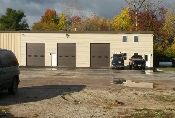
The 9-acre Kearsarge Metallurgical Corp. (KMC) Superfund site is in Conway, New Hampshire, on the north shore of Pequawket Pond. From the mid-1960s through the early 1980s, KMC made stainless steel castings on-site. The manufacturing process created waste casting sands, wax and solvents. KMC dumped these wastes in a wooded wetland east of the facility. When operations ceased, the New Hampshire Department of Environmental Services (NHDES) and the EPA found a waste pile, soils and groundwater contaminated with solvents. The EPA added the site to the National Priorities List (NPL) in 1984. Cleanup began in 1992. It included removal of 13,620 tons of contaminated soils and construction of a groundwater treatment plant. During 12 years of operation, the plant treated over 250 million gallons of water and removed more than 225 pounds of contaminants. In 2013, the town sold the site property at auction to help invigorate the surrounding industrial park. The EPA and NHDES addressed remaining groundwater contamination with a soil treatment remedy in 2015. A towing company, a heating business, and a farm equipment and diesel truck repair facility are currently located in the former groundwater treatment plant and part of the original KMC building. The site’s ecological resources include forested wetlands that provide habitat along the northern bank of Pequawket Pond.
Last updated September 2024
As of December 2023, the EPA had data on 3 on-site businesses. These businesses employed 6 people and generated an estimated $693,000 in annual sales revenue. For additional information click here.
For more information:
- Site Redevelopment Profile: Kearsarge Metallurgical Corp. Superfund Site (PDF)
- Reuse and the Benefit to Community: Kearsarge Metallurgical Corp. Superfund Site (PDF)
- Superfund Site Profile Page
KEEFE ENVIRONMENTAL SERVICES (KES)
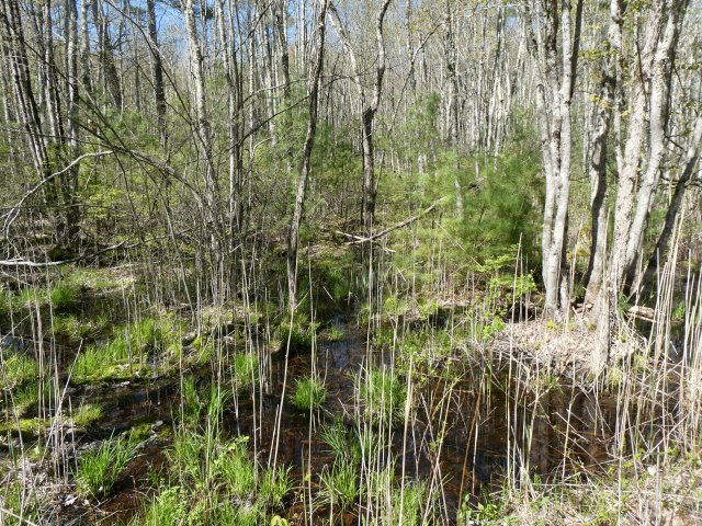
The 7-acre Keefe Environmental Services (KES) Superfund site is in Rockingham County, New Hampshire. KES ran a chemical waste storage facility on-site from 1978 to 1981, when it filed for bankruptcy and abandoned its facility. Solvents, acids, caustics, heavy metals, paint sludges, waste oils and organic chemicals were disposed of at the site. Facility operations led to soil and groundwater contamination, on-site and off-site. The EPA added the site to the National Priorities List (NPL) in 1981. Short-term cleanup included drawing down a waste lagoon to prevent it from overflowing, removing the contents of the lagoon and nearby contaminated soil, and removing drums and aboveground tanks. Long-term cleanup included removing and treating contaminated groundwater and wetlands restoration. The EPA transferred responsibility for remaining cleanup to the state of New Hampshire in 2005 and updated the cleanup remedy from groundwater treatment to monitored natural attenuation. In 2021, the state removed liquid and solid waste for off-site disposal. Monitoring of groundwater and surface water is ongoing. Institutional controls in the form of deed notices are in place to manage the use of groundwater to prevent potential exposure to contamination. The site is in a state-protected watershed with wetland areas that drain to the Piscassic River and Fresh River. A solar array was considered for the site. The town of Epping owns the site property and uses the former treatment facility for maintenance equipment storage.
Last updated September 2024
As of December 2023, the EPA did not have economic data related to on-site businesses, or economic data were not applicable due to site use. For additional information click here.
For more information:
OTTATI & GOSS/KINGSTON STEEL DRUM
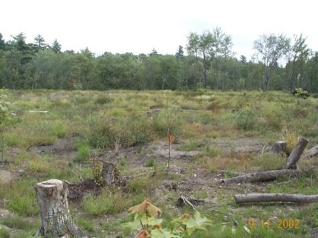
The 35-acre Ottati & Goss/Kingston Steel Drum Superfund site is in Kingston, New Hampshire. The site includes a 6-acre parcel, known as the Great Lakes Corporation area, and a 1-acre parcel, known as the Ottati & Goss area. From the late 1950s through 1980, various owners reconditioned steel drums at the Great Lakes Corporation area. Discharge of industrial wastes into lagoons, runoff and seepage from this area into nearby surface water killed fish and aquatic vegetation. From 1978 through 1979, site operators processed waste at the Ottati & Goss area. Activities contaminated soil, groundwater and surface water. After operations ended in 1979, the New Hampshire Bureau of Solid Waste Management (the Bureau) prohibited site operators from restarting operations. The Bureau ordered the removal of thousands of deteriorating and leaking drums from the site. The EPA placed the site on the National Priorities List (NPL) in 1983. Cleanup activities included the removal of leaking drums and thousands of tons of soil and debris, excavation and on-site treatment of soil and sediment using low temperature thermal desorption, treatment of site groundwater and soil using in-place chemical oxidation, and wetland restoration for ecological reuse. Wetland restoration included placing over 20,000 cubic yards of manufactured wetland material and planting more than 1,000 trees and shrubs. A Town Ordinance and Groundwater Management Zone is in place to prevent use of groundwater and disturbance to the wetlands while an Activity Use Restriction (AUR) is in place to restrict activities which would impact soils below 6 feet.
Last updated September 2024
As of December 2023, the EPA did not have economic data related to on-site businesses, or economic data were not applicable due to site use. For additional information click here.
For more information:
PEASE AIR FORCE BASE

The 4,000-acre former Pease Air Force Base is in Rockingham County, New Hampshire. From the 1950s until 1991, the U.S. Air Force (Air Force) used the facility to maintain military aircraft. Aircraft maintenance operations contaminated soil and groundwater with solvents and fuel. The EPA added the site to the National Priorities List (NPL) in 1990. In 1992, the Air Force transferred 1,702 acres of the site to the local government for use as a public airport. The Air Force kept 229 acres for the New Hampshire Air National Guard. The New Hampshire Department of Transportation leased 20 acres for a highway expansion project. The Air Force also transferred 1,054 acres to the U.S. Fish and Wildlife Service for creation of the Great Bay National Wildlife Refuge. The refuge is a designated National Estuarine Research Reserve that supports ecological reuse, recreation, scientific study, and a community wildlife garden. In 1997, the Air Force transferred 1,300 more acres to the U.S. Fish and Wildlife Service. In 2000, the Pease Development Authority completed the Pease International Tradeport. In 2005, the Air Force transferred the remaining 268 acres of the site to the Pease Development Authority. Redevelopment of this area is ongoing. In 2015, the EPA issued an Administrative Order to the Air Force under the Safe Drinking Water Act requiring the design and construction of two treatment systems to address groundwater contamination that impacted and threatened public and private well drinking water supplies while also expediting the investigation and cleanup of the emerging contaminants perfluorooctanoic acid (PFOA) and perfluorooctanesulfonic acid (PFOS) in the aquifer. The Air Force operates two treatment systems for contaminated groundwater and continues to conduct investigations on-site. Both groundwater treatment systems are operational and removing per- and polyfluoroalkyl substances (PFAS) from extracted groundwater. The Air Force also financed a new drinking water treatment facility. The facility was designed and constructed by the city of Portsmouth to treat PFAS-contaminated drinking water from the three Pease Tradeport supply wells. In early 2021, the Air Force began the remedial investigation under Superfund to determine the full nature and extent of these emerging contaminants in the Pease environment. Results of the remedial investigation will be used to assess potential remedial options that are required to address any unacceptable risks posed to human health and the environment. The assessment of remedial options will be detailed in a future feasibility study. The thriving Tradeport business park is home to over 200 businesses. The site also supports Portsmouth International Airport, the New Hampshire Air National Guard and a golf course.
Last updated September 2024
As of December 2023, the EPA had data on 216 on-site businesses. These businesses employed 6,590 people and generated an estimated $2,184,058,488 in annual sales revenue. For additional information click here.
For more information:
- Reuse and the Benefit to Community: Pease Air Force Base Superfund Site (PDF)
- Superfund Site Profile Page
SAVAGE MUNICIPAL WATER SUPPLY
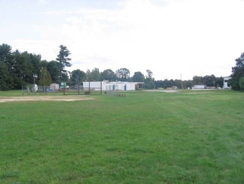
The Savage Municipal Water Supply Superfund site is in Milford, New Hampshire. From the 1940s to the 1980s, four industrial facilities southwest of a municipal well released untreated process waters and wastes into the groundwater and surface water. In February 1983, during routine sampling, the New Hampshire Water Supply and Pollution Control Commission found groundwater contamination above drinking water standards in the municipal well. It was immediately closed. The EPA added the site to the National Priorities List (NPL) in 1984. EPA, the New Hampshire Department of Environmental Services (NHDES) and the potentially responsible parties worked together to clean up the site. Cleanup included pumping and treating groundwater on-site, installing a slurry wall to isolate groundwater contamination, and extracting harmful vapors from soil. It also included institutional controls to prohibit the use of contaminated groundwater and to protect occupants of new buildings from vapor intrusion in some areas of the Site. Groundwater treatment and monitoring is ongoing. Land uses in the area include residential, agricultural, industrial and commercial areas. Uses on-site include agricultural, commercial, recreational and ecological areas. Examples of these include a baseball park and the Souhegan River Trail.
Last updated September 2024
As of December 2023, the EPA did not have economic data related to on-site businesses, or economic data were not applicable due to site use. For additional information click here.
For more information:
SOMERSWORTH SANITARY LANDFILL

The 26-acre Somersworth Sanitary Landfill Superfund Site is in the City of Somersworth, New Hampshire. The City of Somersworth operated a waste disposal area at the Site from the mid-1930s until 1981. The City burned residential, commercial, and industrial wastes at the Site. In 1958, the City stopped burning waste and converted the area into a landfill. Improper disposal practices contaminated the soil, sediment, and groundwater at the Site. The EPA added the Site to the National Priorities List (NPL) in 1983. Cleanup included groundwater containment and treatment, a landfill cover, and gas venting, as well as land and groundwater use restrictions. Prior to the Site’s listing on the NPL, the City covered a 10-acre portion of the Site with clean fill for use as a recreation area. This area was available for passive recreation, such as walking, until the City closed it in 2011. The rest of the Site is undeveloped as it contains the former landfill and wetlands downgradient from it. In 2013, the EPA presented the City with an initial assessment of renewable energy opportunities for the Site. In August 20, 2021, land use restrictions were recorded on the property that allowed for solar development. In early 2022 Ameresco Inc. (dba Blackwater Rd Solar LLC) contacted the EPA regarding the compatibility of a solar co-generation facility within the Site. After several discussions they requested the EPA provide them with a CERCLA comfort letter, which described the Site cleanup and the use restrictions, which was issued by the EPA in August 2022. In early 2023, the City contracted Blackwater Rd Solar LLC, to re-develop the 10-acre former recreation area of the Site into a solar array facility that will be leased from the City. Blackwater Rd Solar LLC visited the Site and held preliminary discussions with the EPA and the New Hampshire Department of Environmental Services (NHDES), which culminated in the submittal of a Reuse Report to both agencies and the submittal of an application for Alteration of Terrain (AOT) permit, to NHDES, in September 2023. The EPA and NHDES reviewed and discussed those submittals with Blackwater Rd Solar LLC, the City and the City’s consultant (Geosyntec Inc.). These discussions resulted on a revised version of both documents which was submitted in March 2024. The EPA and NH DES reviewed and discussed the revised version of the Reuse Report and approved it on April 1, 2024. NHDES, after consultation with EPA, approved the AOT permit on April 24, 2024. Blackwater Rd Solar LLC plans to start the construction of the solar array in late July 2024 and finalize it on/before end of December 2024.
Last updated September 2024
As of December 2023, the EPA did not have economic data related to on-site businesses, or economic data were not applicable due to site use. For additional information click here.
For more information:
- Superfund Site Profile Page
-
Video: Somersworth Sanitary Landfill Superfund Site Redevelopment
SYNERGY (FORMER)
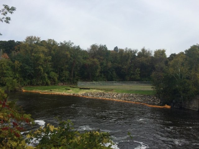
The Former Synergy Site is located in Claremont, New Hampshire. From the turn of the century until the mid-1940s, a manufactured gas plant operated on site. Operations contaminated soil with coal tar, a common contaminant of that process. Between 2010 and 2012, investigations identified waste perched on bedrock that was leaching into the Sugar River. Cleanup activities included removing structures and soil, stabilization, and capping. Because of the historical importance of the gas plant to the town’s textile history and the EPA’s obligations under the Historical Preservation Act, the EPA coordinated with the State Historic Preservation Office during cleanup activities. A brick-and-concrete structure with informative plaques now memorializes the site’s history. The site is located near a visitor's center and is part of the community’s historic downtown area. The site is currently a picturesque open space on the banks of the Sugar River. Looking forward, the town will consider reuse options for the property.
Last updated September 2024
As of December 2023, the EPA did not have economic data related to on-site businesses, or economic data were not applicable due to site use. For additional information click here.
For more information:
SOUTH MUNICIPAL WATER SUPPLY WELL
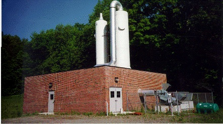
The 250-acre South Municipal Water Supply Well Superfund site is in the Contoocook River Valley in Peterborough, New Hampshire. Installed in 1952, the South Municipal Water Supply Well provided water to Peterborough for nearly 30 years. In 1982, testing by the state of New Hampshire found contaminants in the groundwater, which resulted in the closing of the well. Investigations found that the nearby New Hampshire Ball Bearings facility was the source of the contamination. The facility has made precision ball bearings since 1956. Activities at the facility contaminated soil, groundwater, and wetland sediments. The EPA added the site to the National Priorities List (NPL) in 1984. Initial cleanup activities included groundwater and soil treatment, off-site disposal of contaminated sediments, and wetland restoration. Later, the EPA determined that restoration of some of the contaminated groundwater at the site was not possible. The EPA updated the remedy to contain the groundwater instead of treating it. In 2008, the EPA found that the remedy was not functioning as intended. The EPA updated the cleanup plan in 2010 to change source control and migration management activities. To manage migration of contaminated groundwater, New Hampshire Ball Bearings installed a permeable reactive barrier (a below-ground wall) in 2014. In-place thermal treatment of an on-site source area finished in 2016. The permeable reactive barrier is not functioning as intended and a replacement permeable reactive barrier is currently being constructed. Current site uses include the 24-acre New Hampshire Ball Bearings manufacturing plant, commercial and residential properties, part of U.S. Route 202 and wetlands.
Last updated September 2024
As of December 2023, the EPA had data on 4 on-site businesses. These businesses employed 363 people and generated an estimated $36,818,396 in annual sales revenue. For additional information click here.
For more information:
TINKHAM GARAGE
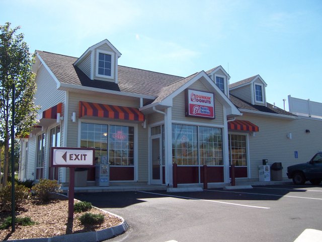
The 375-acre Tinkham Garage Superfund site is in Londonderry, New Hampshire. In 1978, residents downgradient of the site complained of foam and odors in a small unnamed stream that crosses the site and goes through the nearby neighborhood. Investigators found impacted public and private water supply wells along the northwest part of the site as well as soil and groundwater contamination across the site. In 1983, the EPA added the site to the National Priorities List (NPL). Cleanup activities included groundwater and soil treatment, extension of the public water line to the condominium complex and nearby houses and groundwater monitoring. The remedy changed to monitored natural attenuation in 2003 and long-term monitoring started. Connection to a water line was required in 2016 to address contamination found in water supply wells in a neighborhood east of the garage. An ongoing investigation has found emerging contaminants in groundwater and the migration of site contaminants into downgradient neighborhoods where residents rely on groundwater as a drinking water source; selection of an alternative water source is being considered. Groundwater use is monitored under a groundwater management permit issued by the New Hampshire Department of Environmental Services. A revised groundwater remedy is expected at the completion of the investigation. Today, a shopping complex with a Home Depot, Staples and Dunkin’ Donuts occupies the northeast area of the site. The Woodland Village Condominium complex and several single-family homes remain on the north/northwestern part of the site. The Nevins Retirement Cooperative Association completed construction of over 125 senior housing single-family homes on the central part of the site. Site redevelopment has increased property values in Londonderry. Increased economic activity at the site has also encouraged local infrastructure improvements.
Last updated September 2024
As of December 2023, the EPA had data on 7 on-site businesses. These businesses employed 349 people and generated an estimated $95,365,070 in annual sales revenue. For additional information click here.
For more information:
TOWN GARAGE/RADIO BEACON
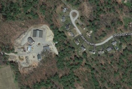
The Town Garage/Radio Beacon Superfund site is in Londonderry, New Hampshire. The U.S. Department of Defense owned part of the site from the early 1940s until 1968 and operated a radio beacon there during World War II. Afterwards, the area hosted residential wells and one commercial well. A 1984 state inspection found groundwater contamination in many of the wells. In the late 1980s, six homes with impacted wells connected to the local public water supply. As a precaution, several other homes have since connected to the public water supply. The EPA added the site to the National Priorities List (NPL) in 1989. Cleanup activities included annual monitoring of natural processes to clean up groundwater and placing restrictions to prevent groundwater use for household purposes. The success of the EPA’s cleanup plan allowed for site reuse. Today, the site includes two residential developments, a garage operated by the Londonderry Department of Public Works, and a wetland area. The Holton Circle development includes about 25 homes. The Saddlebrook development includes 20 new homes. In 2014, the EPA deleted the site from the NPL.
Last updated September 2024
As of December 2023, the EPA did not have economic data related to on-site businesses, or economic data were not applicable due to site use. For additional information click here.
For more information:
TROY MILLS LANDFILL
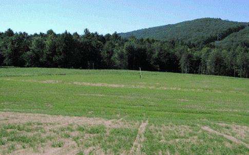
The Troy Mills Landfill Superfund Site is part of a larger 270-acre parcel in Troy, New Hampshire. From 1967 until 1978, Troy Mills Inc. used the property to dispose of solid waste and hazardous materials generated by its manufacturing plant. In 1978, the state of New Hampshire ordered the company to stop these disposal practices. During the 1980s and 1990s, environmental investigations confirmed site soil, groundwater, surface water and sediment contamination. Troy Mills Inc. filed for bankruptcy in 2001. The EPA placed the site on the National Priorities List (NPL) in 2003. Cleanup actions included the removal of 7,692 drums containing flammable liquid waste, waste sludge, and contaminated soil. The cleanup also installed a system to collect hazardous materials from groundwater and placing a deed restriction on part of the property to prevent groundwater uses until groundwater cleanup levels were achieved. After removing the drums and associated contaminated soil, the EPA backfilled excavated areas and capped them. In 2005, the EPA supported community efforts to identify reuse options for the site. The community expressed interest in a recreation area. Most recently, the Appalachian Mountain Club has expressed interest in re-routing part of the adjacent Monadnock Recreational Rail Trail system through a portion of the 270-acre parcel. Possible future recreation opportunities at the site include hiking, horseback riding, mountain biking and cross-country skiing. Reuse of a portion of the Site, and an adjacent solid waste landfill managed by the New Hampshire Department of Environmental Services (NHDES), as a potential solar co-generation facility is being explored by the EPA and NHDES, working with an EPA reuse contractor.
Last updated September 2024
As of December 2023, the EPA did not have economic data related to on-site businesses, or economic data were not applicable due to site use. For additional information click here.
For more information:
